Another storm is brewing in the Bay of Bengal, and Andhra Pradesh may be in its path
A depression formed early on Sunday and the IMD expects it to strengthen into a cyclonic storm, then a severe one. Where it reaches land is still uncertain.
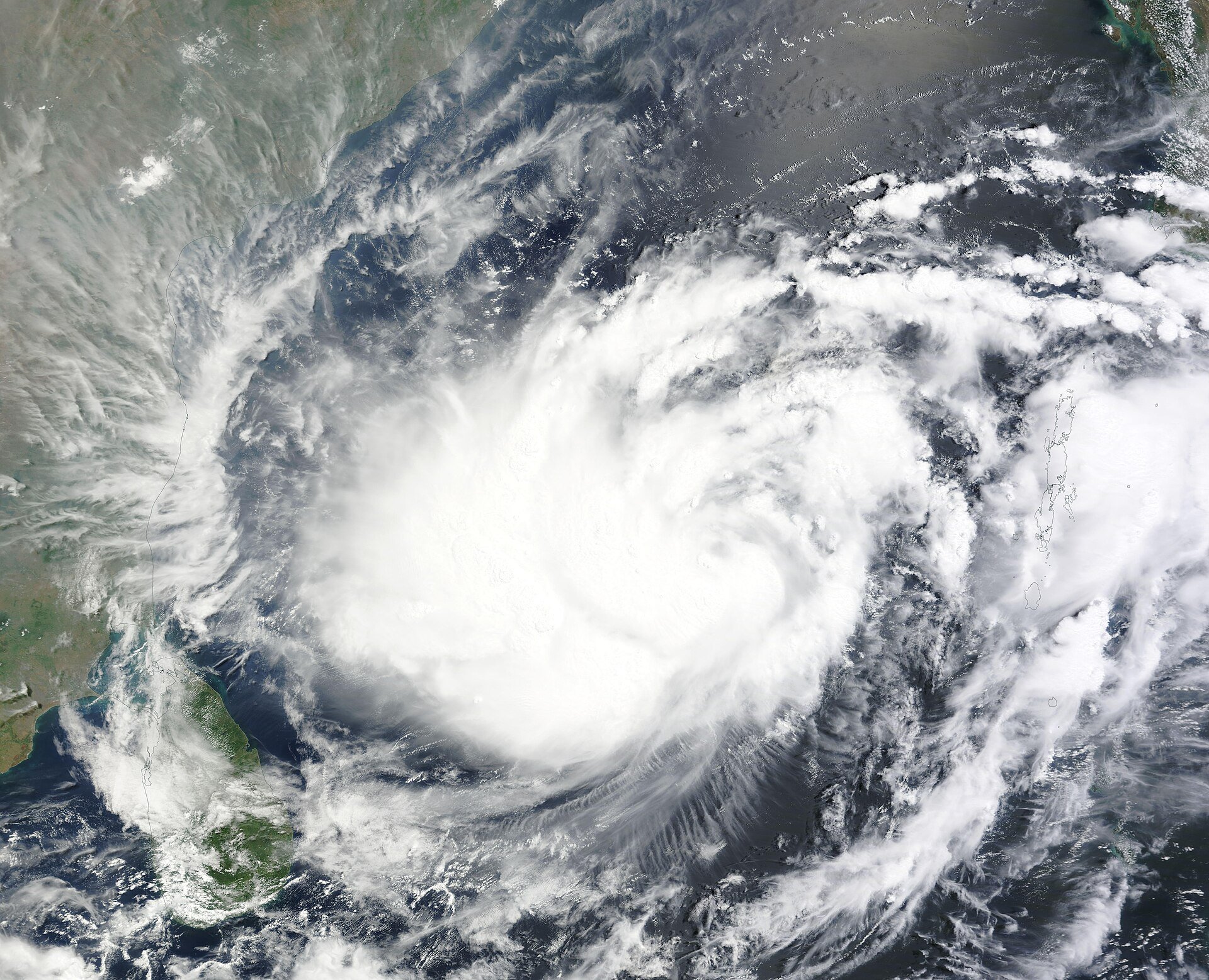

If you thought this year's Bay of Bengal storms were done after Cyclones Arnab and Murasu, think again. A depression, an early stage on the way to a cyclone, formed over the southeast Bay of Bengal at 5:30 am on Sunday, and the India Meteorological Department (IMD) expects it to grow into a cyclonic storm by Monday evening, ANI reported.
At 8:30 am on Sunday, the system was centred about 840 km east-southeast of Chennai and about 1,010 km south-southeast of Visakhapatnam, moving almost due north at around 10 kmph, Business Today reported, citing the IMD. That's still far out at sea, which is why nobody on the coast is feeling much yet.
Here's the timeline the weather office is working with. Both ANI and Business Today reported that the IMD expects the depression to become a cyclonic storm on Monday (Saturday's IMD release had said Monday evening) over the central parts of the south and west-central Bay of Bengal, and a severe cyclonic storm on Tuesday. For now, the IMD says it is "very likely to move north-northwestwards", and Business Today reported that it could then turn northwest towards the Andhra Pradesh coast over the following two days.
So where will it actually hit land? Honestly, it's too early to tell. Business Today noted that the IMD's track leans towards Andhra Pradesh, while weather blogger Pradeep John said several AI-based models favour north Tamil Nadu. DT Next quoted Pradeep John, who blogs as Tamil Nadu Weatherman, as saying different models point to south or north Andhra Pradesh and that a firm call can't be made yet. Bay of Bengal storms have a habit of changing course late, so it's worth following official updates rather than forwarded WhatsApp maps.
The IMD's press release on Saturday, issued before the depression formed, already sketched out what may follow. It forecast isolated heavy rain over the Andaman and Nicobar Islands until 16 November, isolated heavy to very heavy rain in north coastal Andhra Pradesh between 18 and 20 November, very heavy rain in parts of Odisha on 19 and 20 November, and heavy rain in Gangetic West Bengal on those two days. Those dates could shift as the forecast is updated.
Out at sea, the warnings are sharper. Saturday's IMD release said gale-force winds of 65 to 75 kmph, gusting to 85 kmph, are likely over the central Bay of Bengal from 17 November. Fishermen were told to return to the coast by 15 November and to stay out of the southwest Bay until 18 November and the central Bay from 16 to 19 November.
The Coast Guard isn't waiting. It has set up disaster response teams along the Tamil Nadu, Puducherry and Andhra Pradesh coasts and is broadcasting advisories to fishermen in regional languages, PTI reported on Saturday.
What happens next? If the depression becomes a cyclone on Monday, it will get a name and the IMD will start issuing more frequent bulletins with a clearer landfall estimate. If you live on, or plan to travel to, the Andhra Pradesh or Odisha coast later this week, keep an eye on those updates and on your state's disaster advisories.
Get the day's best stories on WhatsApp. Free, a few a day, no spam.
Follow on WhatsAppSource ledger · स्रोत खाता
Each fact in this story, where it came from, and how it was checked.
| Fact | Source | Check |
|---|---|---|
| Depression formed over southeast Bay of Bengal at 05:30 IST on 15 Nov | ANI | Single source |
| At 08:30 IST, centred ~840 km ESE of Chennai and ~1,010 km SSE of Visakhapatnam, moving north at ~10 kmph | Business Today | Single source |
| Expected to become a cyclonic storm on 16 Nov evening and a severe cyclonic storm on 17 Nov | ANI | Confirmed, independent outlets |
| Cyclonic storm around the evening of 16 Nov (forecast before depression formed) | India Meteorological Department | Confirmed, official source |
| IMD track leans towards Andhra Pradesh coast; some AI models favour north Tamil Nadu | Business Today | Single source |
| Pradeep John: models point to south/north Andhra Pradesh, too early for definite prediction | DT Next | Single source |
| Rain forecast: A&N isolated heavy to 16 Nov; north coastal AP isolated heavy 18 and 20 Nov, very heavy 19 Nov; Odisha very heavy 19-20 Nov; Gangetic WB heavy 19-20 Nov | India Meteorological Department | Confirmed, official source |
| Gale winds 65-75 kmph gusting 85 kmph over central Bay from 17 Nov | India Meteorological Department | Confirmed, official source |
| Fishermen to return by 15 Nov; avoid southwest Bay 15-18 Nov and central Bay 16-19 Nov | India Meteorological Department | Confirmed, official source |
| Coast Guard disaster response teams along TN, Puducherry, AP coasts; advisories in regional languages | ThePrint (PTI) | Single source |
Corrections to this story: none.